Version 5.18
The new version of GreenSpaces introduces the possibility of adding a risk assessment to the tree assessment form.
For this purpose, the menu formerly called “VTA” (with reference to the SIA methodology) was renamed to “Tree assessments”, so that different assessment methodologies can be included.
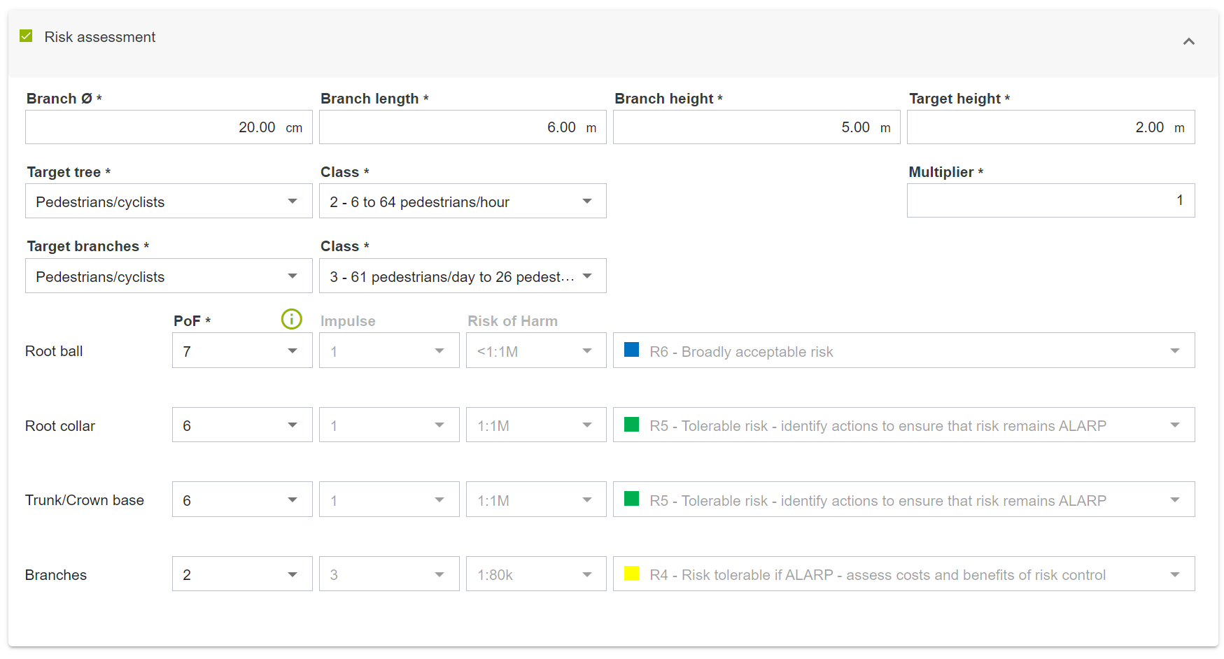
The new version of GreenSpaces introduces in the tree assessment form the possibility of adding a risk assessment following the Areté methodology.
Risk analysis requires additional information on various parts of the plant in order to assess the probability of failure (PoF) and vulnerability of the site where the plant is located:
-
the initial tree assessment section remains unchanged compared to a traditional visual assessment;
-
the second section allows to asses the risk and probability of failure (PoF) of different parts of the plant, calculating a risk class in real time, based on the values provided by the Arete protocol.
With the release of the previous version (5.17), we introduced some rules for better management of tree assessment forms and to reduce the likelihood of having more than one assessment form “In process” for the same tree at the same time. To sum up:
-
It is no longer possible to create a new tree assessment form on a tree for which there is already a tree assessment form “In process”;
-
It is no longer possible to “Plan an assessment” for a tree for which there is already a tree assessment form “In process”;
-
A rule was introduced that allows validation only in temporal order, i.e. in the same order in which the assessments were conducted.
-
The semantic data of the tree form are not overwritten with the data of the older assessment form to be validated;
-
The jobs proposed by the tree assessment that you are validating will be added to the planning as usual and can be archived manually if they are no longer needed.
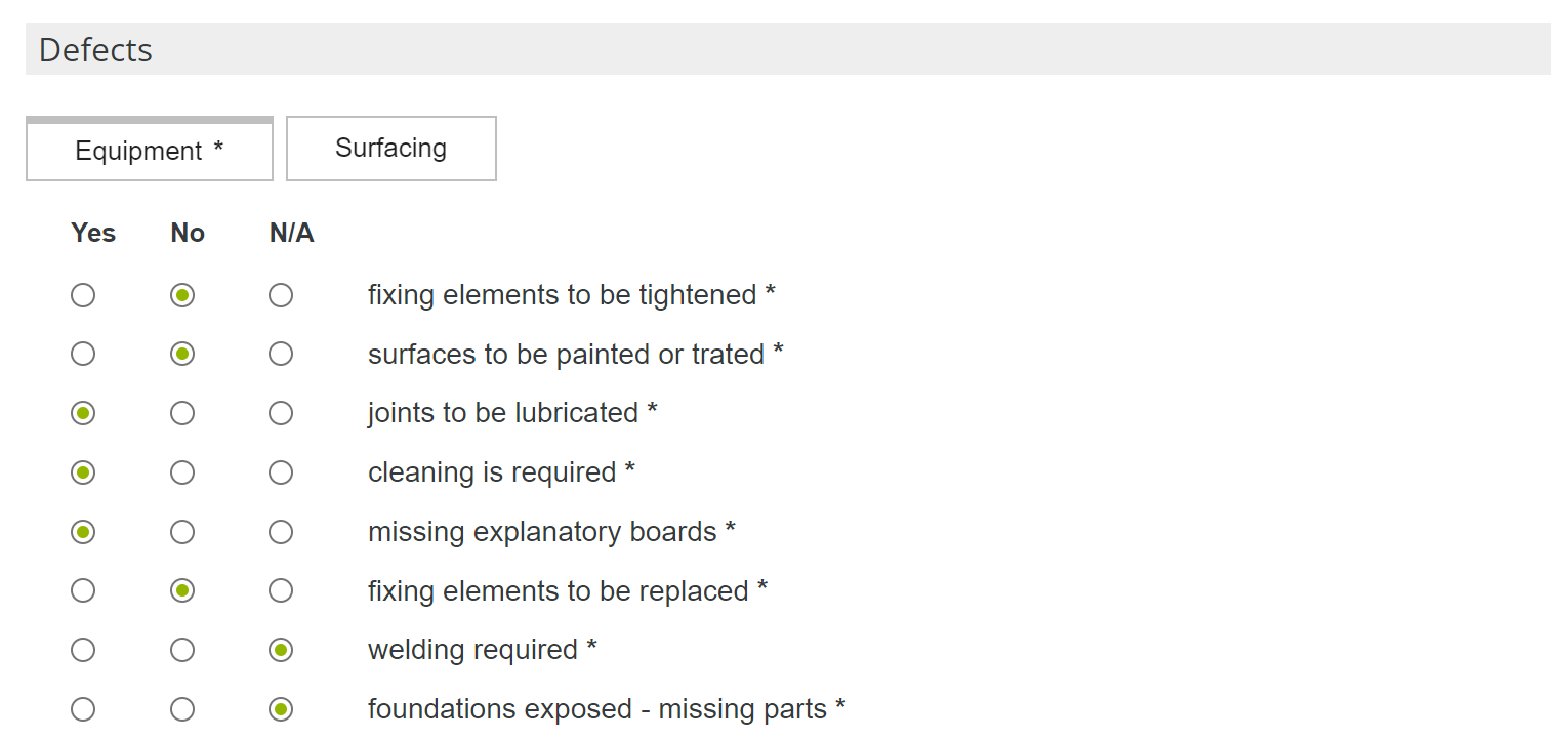
The inspection form for play and sports equipment has been revised to bring it into compliance with current regulations. It is now possible to configure different types of inspection, and each type of inspection can have a different list of defects to be inspected.
Furthermore, it is possible to configure a "Controls category" with the flag "Mandatory evaluation". In this case, the simple checkbox (Yes/No) is replaced by three boxes, respectively Yes, No, n/a, which must be filled in (see image). In this way, it is now also possible to explicitly report the absence of a particular defect, while confirming that it has been inspected. The three boxes are also shown in the pdf printout of the inspection.
Within the Interreg VerdeVale project a new statistics extraction tool has been implemented, which allows monitoring the status of some indicators that are strategic for the daily management of urban green. These statistics involve extraction of tables and graphs on certain parameters and are available as 9 additional new types of pdf printouts in the print window
 of the "Sites" "Trees," and "Planned jobs" menus.
ATTENTION: Statistics prints always extract information on the date the print request is made. For GreenSpaces Enterprise version, statistics prints will only be activated if a filter has first been applied to an individual domain.
-
"Sites" menu: Tables and graphs summarise the characteristics of areas according to their classification.
From this menu, by clicking the print button at the top right, you can now choose the new print type "Site statistics" from the drop-down menu (see images below). Selecting the latter allows you to choose whether to produce a printout for the parameter "Classification", "ISTAT Classification" (for Italian clients only), or both.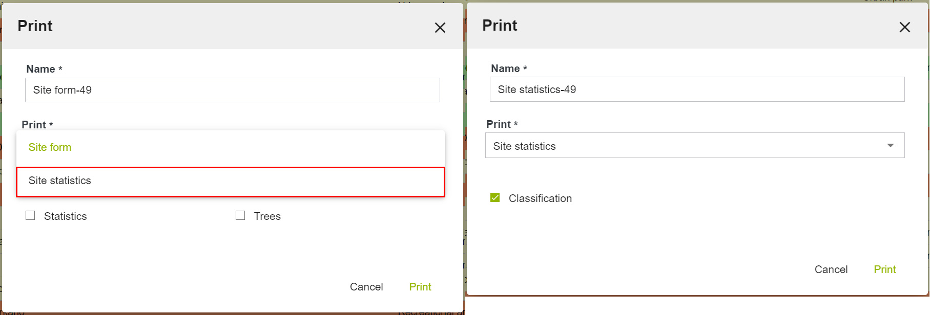
-
"Trees" menu: Monitoring statistics of surveyed trees provide information on species, height and diameter, tree assessment and growth stage.
From this menu, by clicking the print button in the upper right corner, you can now choose the print type "Tree statistics" from the drop-down menu (see images below). By choosing the latter it will be possible to obtain a printout for one, several or all of the following parameters: "Tree assessment," "Genus," "Height," "Stem diameter," or "Growth stage."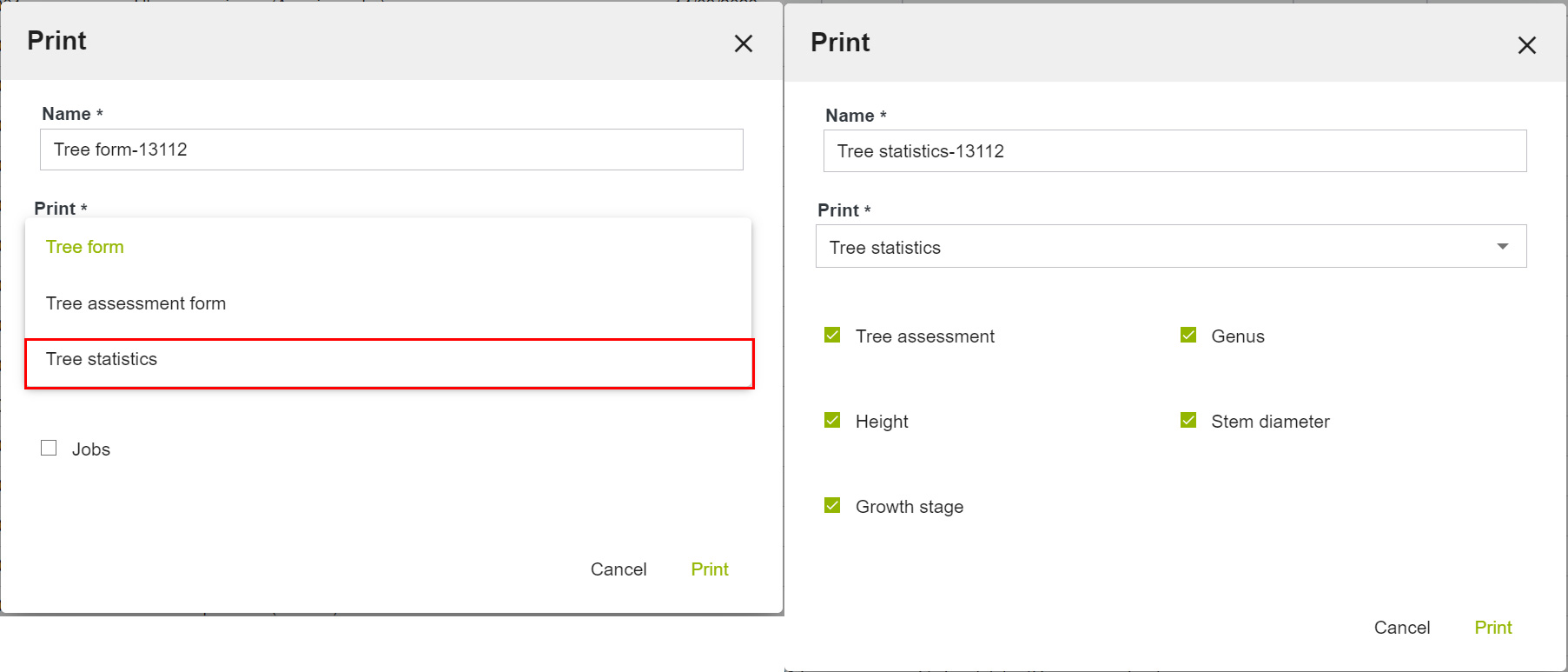
ATTENTION: All tree statistics include in the calculation only trees with status "Living tree" and "Dead tree". For GreenSpaces installations that have the fields "Height" and "Stem diameter" in the tree form configured as classes and not as real numbers, the corresponding and homonymous statistics will be disabled. For trees where the diameter of more than one stem has been registered, the value of the stem diameter for the statistics will be calculated as the overall virtual diameter derived from the overall area of the stem section. -
“Planned jobs" menu: Job status monitoring statistics are available for job categories and activities on trees. From this menu, by clicking on the print button in the top right-hand corner
, it is now possible to choose the new print type "Job statistics" from the drop-down menu. By choosing the latter, it will be possible to obtain a printout for the parameter "Jobs by category", "Jobs on trees" or both.
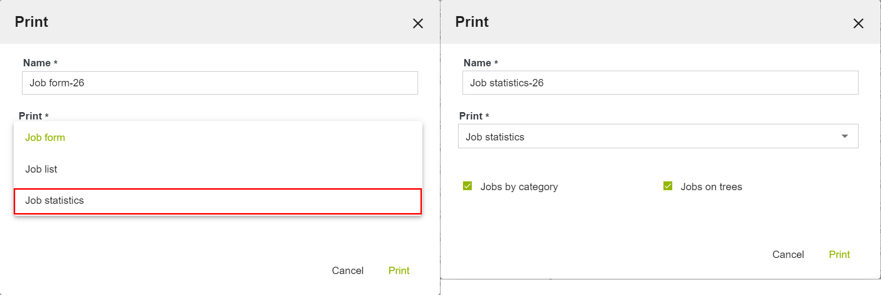
ATTENTION: Job statistics printouts do not include in the calculation jobs in the status 'Archived' or 'Proposed'. For statistics of jobs on trees the software considers only job types valid exclusively and only for the trees (green code P103108).
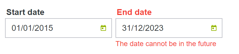
Until now, it was possible to set the "End date" field in the form of a site or playground even with a future date, immediately archiving the object and creating anomalies in the database. With this update, in order to avoid inconsistencies in the database, this issue has been resolved by preventing (and alerting) the user during compilation (see image below) from setting an "End date" in the future.
The "Homogeneous zone" is an attribute of the "Sites" form, which can be activated at the customer's request, and which identifies the level of management of different areas, such as intensively maintained areas or extensive zones.
The new version of GreenSpaces introduces the map view of homogeneous zones.
The corresponding configuration menu has been enhanced with the possibility of choosing a colour for each zone that will be used for the map display.
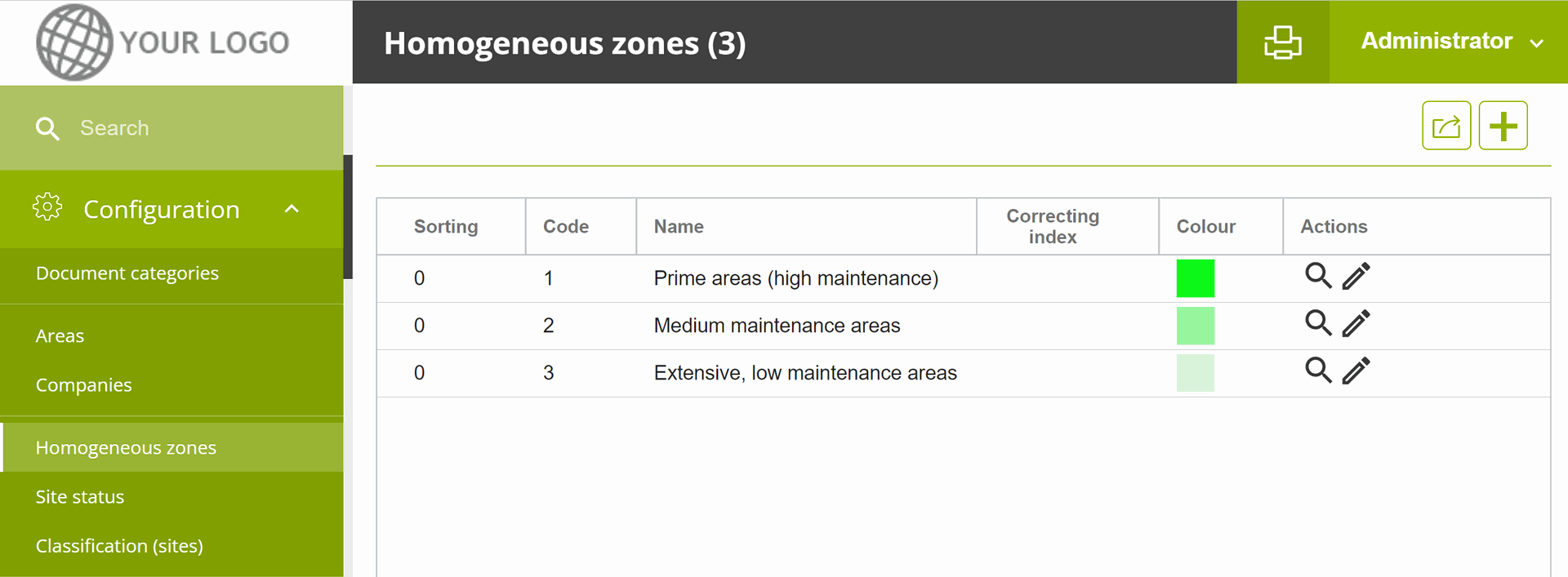
The service is available to all customers who have enabled the "Homogeneous zone" field on their installation.
With the new version of GreenSpaces, it is possible to request R3GIS to enable a new information layer on the map to display additional tree checks. The additional tree check can be found and configured by the client in the corresponding menu under "Configuration".
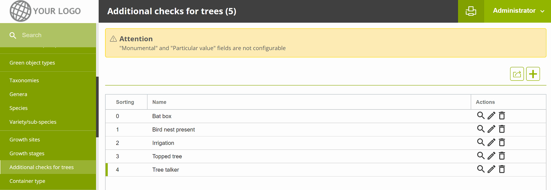
The symbol used is a halo around the tree point; the user is given the option of choosing colours (check yes/no) as well as an alternative symbol; it is also possible to choose which additional checks to enable on the map.
Customised configuration is done by R3GIS staff, after estimating the necessary effort, within the customer's hour package.
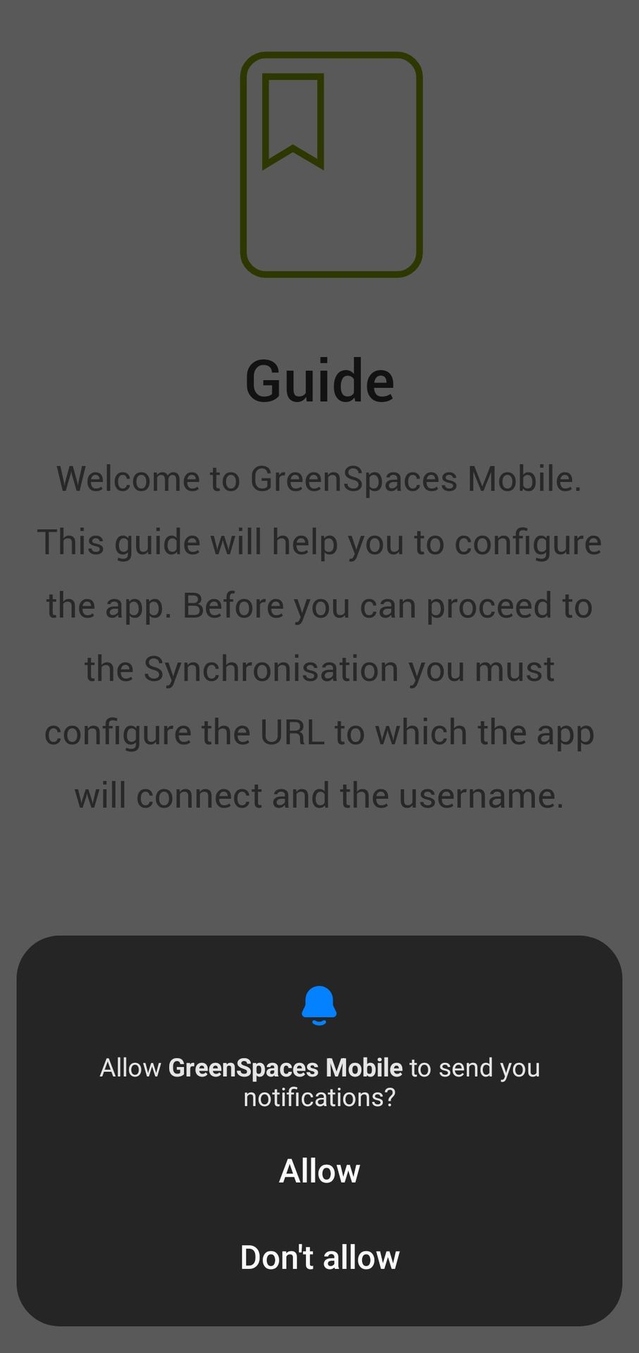
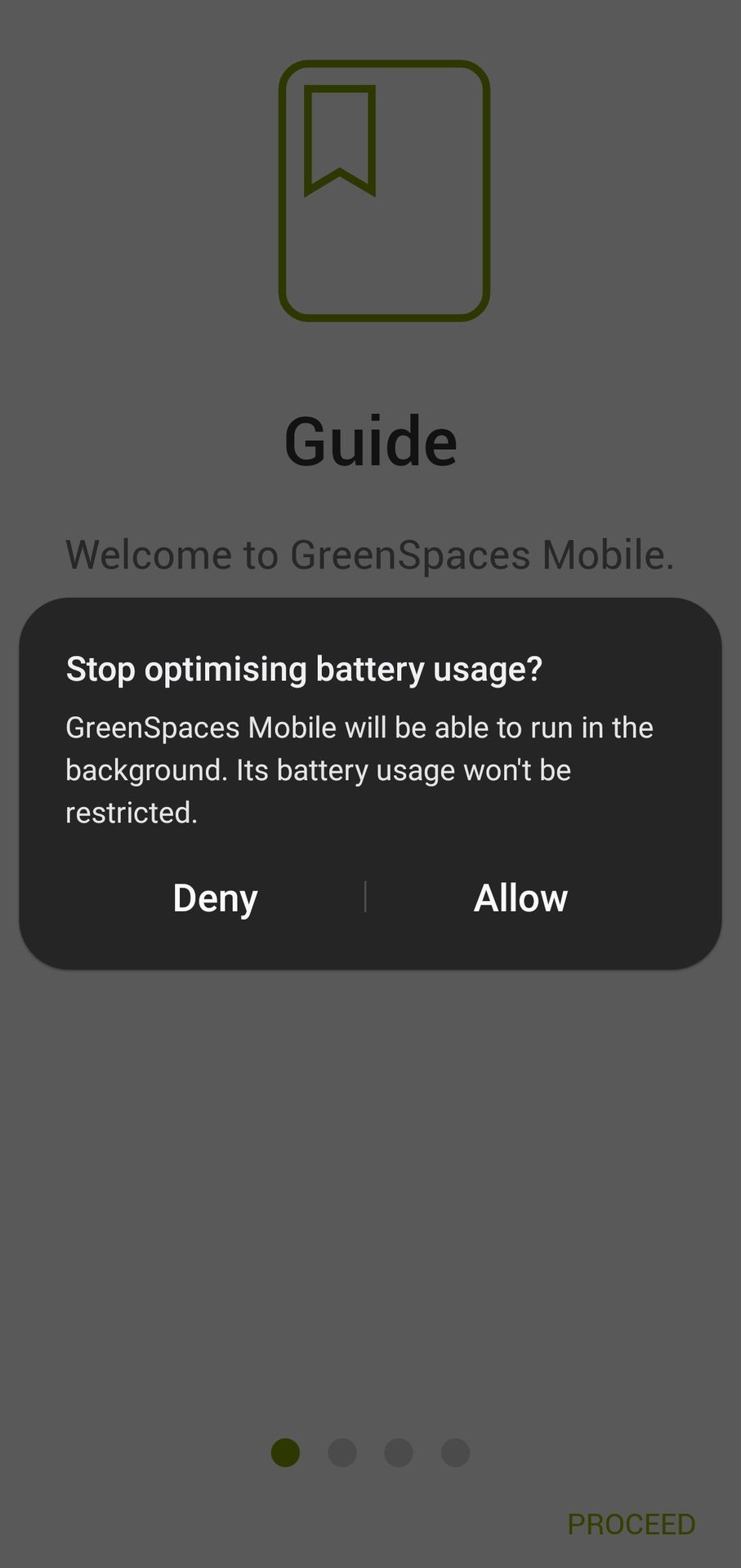
Due to a new energy saving management mode by the android operating system, R3GIS had to change the working of the Mobile App. Some customers have reported a crash of GreenSpaces Mobile when taking photos. The new version of GreenSpaces Mobile requires 2 additional permissions when installing or using it for the first time, namely: notification permission and permission to exclude GreenSpaces Mobile from android's battery saving management.
|
|

|
The App now remains active in the background (recognisable by the icon in the top left-hand corner - see the previous image), until it is intentionally closed (double use of the “back” button or closing by swiping from active Apps.
The new Play/Pause function that can be activated within the WORKS Module is intended to record the hours spent by an operator or team (GreenSpaces users) in carrying out a job assigned to them via job planning.
When a user has enabled Play/Pause on GreenSpaces Mobile, a "Tasks" section appears with a ►Start job button. Clicking on the "Play" symbol automatically changes the status of the job from "To do" to "In progress" and the software starts counting the time spent on the started job. Similarly, if a job is changed from “To do” to “In progress” status, the job is started and the time spent on the started job is counted.
ATTENTION: Any interaction with the Play/Pause button is not taken over by the central database until the user performs a synchronisation. If real-time synchronisation is active on the installation, it will instead be possible to view the start of a job from the web platform even without the mobile app having performed a synchronisation. The 'Real-time sync' module can be purchased separately from the WORKS Module.
A job that has been started can be paused and then restarted as many times as necessary: with each pause, the job's time count is interrupted and then restarted when the play symbol is clicked. Even when the task is paused, the status of the job remains classified as "In progress".
Once the job is finished, the user must change the status of the job by selecting "Completed" from the relevant drop-down menu. If the task is still running at the time of the status change, the change to "Completed" automatically stops the task and the work time count is also interrupted.
If a job is scheduled for several users, the following aspects must be considered:
-
The job changes to "In progress" status when at least one user has recorded a "Play" on that job;
-
The counting of the time spent on the execution of the job by each user works exactly as described above (i.e. there will be a time entry for each user based on their Play/Pause);
-
The job can only switch to "Completed" status when all users scheduled on the job have completed it.
|
|
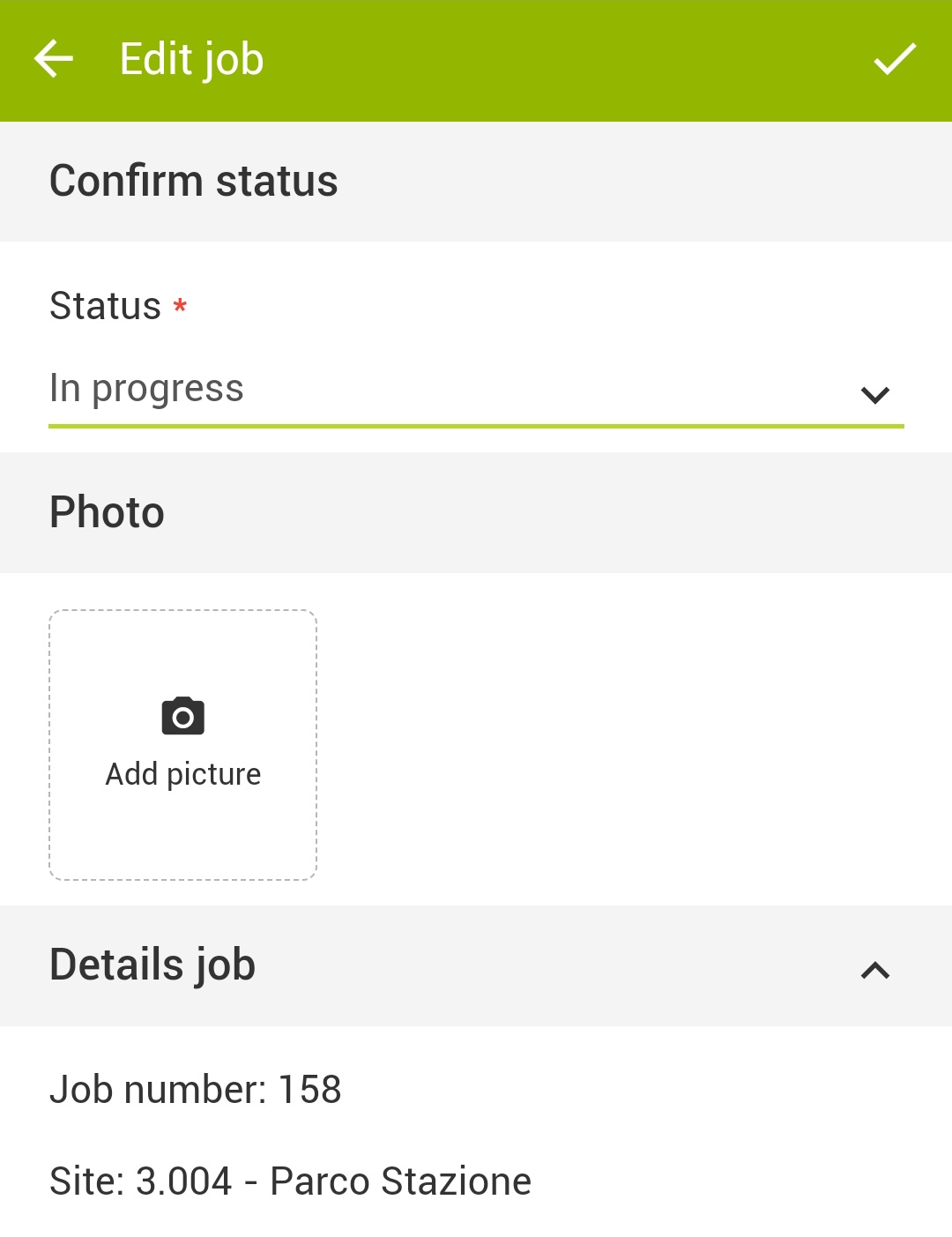
It is now possible to associate one or more photographs in GreenSpaces Mobile when changing the status of a job and setting it to "In progress". Entering the edit tab of a planned job and setting the status to "In progress" will activate the section for adding photographs to be associated with the new job status; you will be able to capture multiple pictures and select the main one. |
|
|
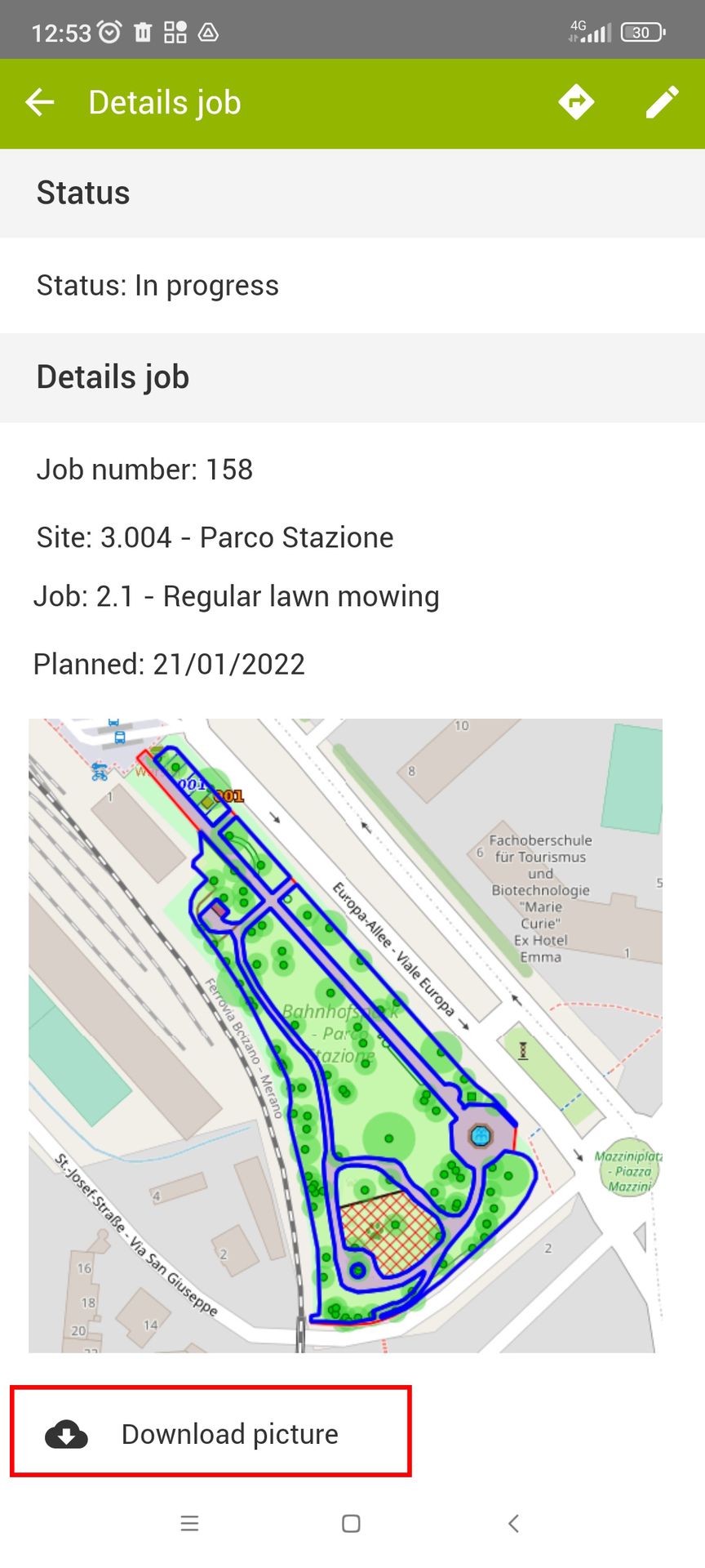
During synchronisation these photographs are uploaded to the central database (GreenSpaces Web) and will no longer be visible from the Mobile App. It is however possible to download the main image by using the respective button in the job form. |
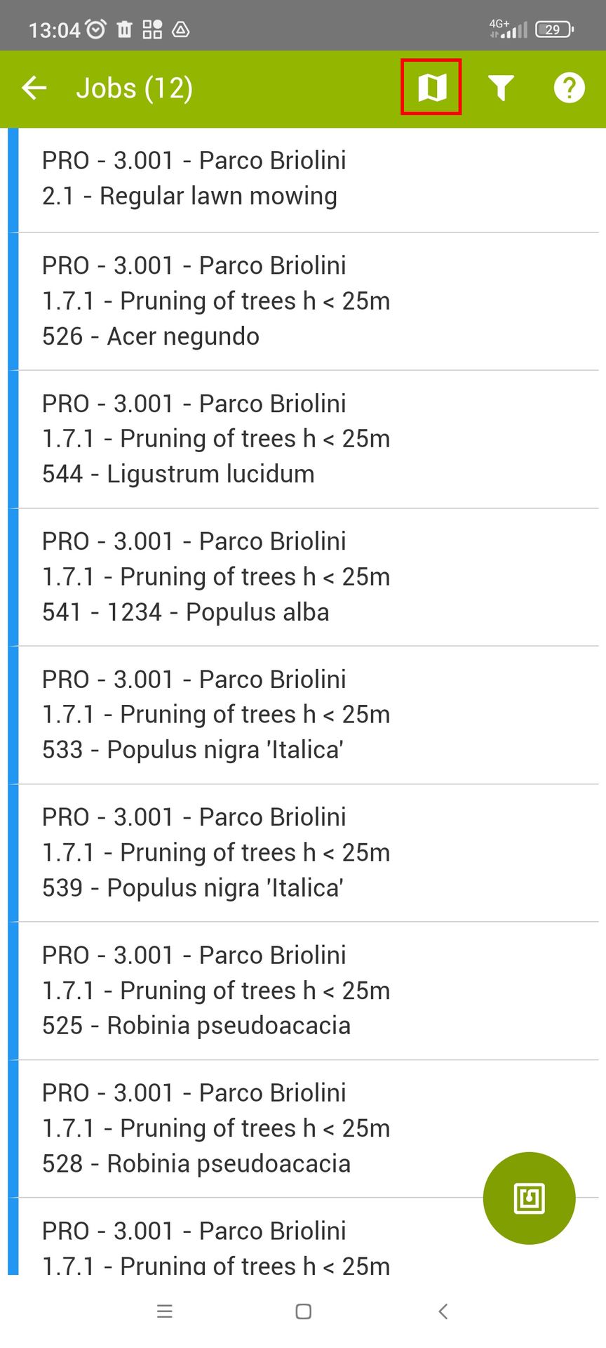
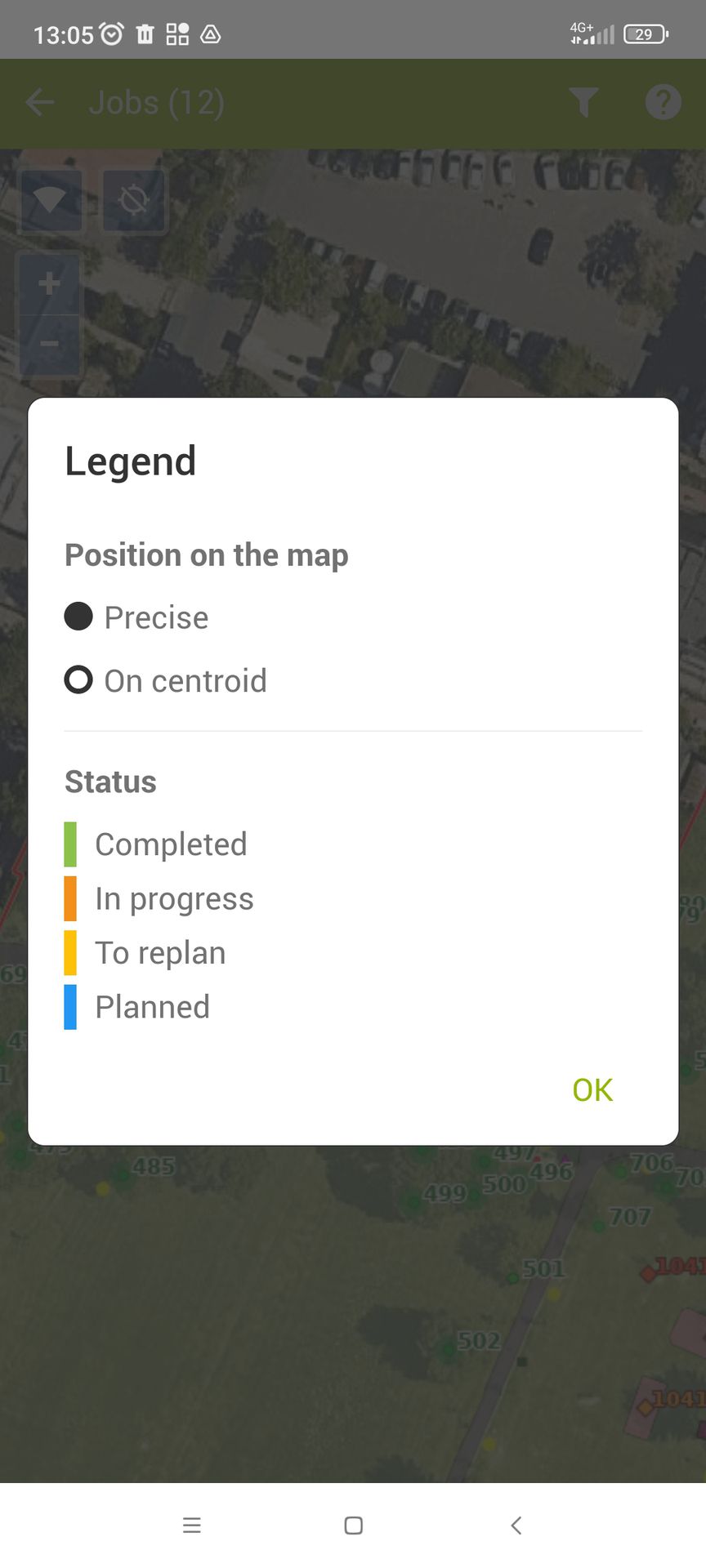
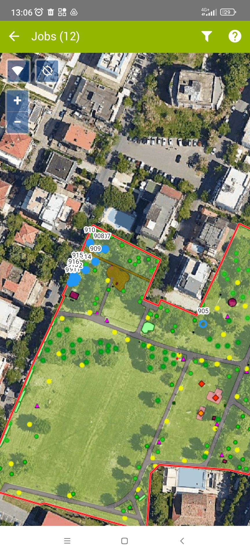
In order to make it easier to identify trees or other objects on which to carry out field work, a map has been added to the "Jobs" module in GS Mobile to consult the location of jobs. This functionality is similar to the existing map for trees and tree assessments.
The position is displayed on the map in two ways:
-
Precise for work planned on a single point object;
-
On the centroid of the geometry for work on linear, polygonal, or multiple objects
|
|
|
|