Version 5.20
An automatism has been created whereby, when a New Job is created on one or more locations, the system automatically fills in the "Company" field if only one company is uniquely assigned to the location.
With this new function, it is possible to export a file in DXF format containing the census geometries of a location. The DXF (Drawing Exchange Format) can be used with CAD drawing software.
In the advanced filters in the Trees menu, it is now possible to search for trees without taxonomy and tag. In fact, in the dedicated section “Trees” of the advanced filter, two new search entries appear: "Tree without Tag" and "Tree without taxonomy".
In the advanced filters of the Planned Jobs menu, there is a new search parameter called "Job without company" that allows the user to search for all those Planned Jobs not assigned to any company.
In addition, new search filters for Trees and Planned Jobs have been implemented, based on the insertion date.
A new "History" tab has been created in the “Empty sites - Trees” form, showing the changes that have occurred on the object (taxonomy, site of growth, growth stage,position and details).
From the "Jobs to be verified" menu, it is now possible to perform multiple actions on jobs via the "Multiple editing" button. This function, already present in the "Planned Jobs" menu, behaves in a similar way but can only be used in validation step 2, i.e. after the first validator has given a judgement in step 1 as to whether or not the job has been executed correctly.
The current version of GreenSpaces provides only one length value on the L1 and L2 object sheet: if there is no geometry, this will be found under the heading "Estimated length" and will be compilable and editable manually; if there is a geometry, on the other hand, the field will be called "Length" and will be automatically filled in by the system with the value calculated from the geometry (and will therefore not be editable manually by the user).
A check on the complexity of user passwords has been implemented. The administrator of a GreenSpaces instance can request activation of the password complexity check and when changing/renewing the password, the system ensures that the new password meets the common complexity criteria.
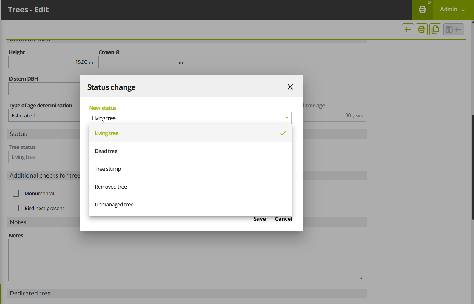
In the Configuration section of the Menu, there is now a "Family" entry for implementing this level of the botanical taxonomy.
Under General > Trees, with the "Multiple Edit" function it is now possible to automatically select all filtered trees in the list on multiple pages by clicking on the "select all filtered objects" button.
In the forms of Sites, Trees, Tools etc. and in the menu filters, the position and size of the fields to be filled in have been optimised to improve editing, consultation and scrolling.
With this version, the list of species for which the calculation of environmental benefits is available has been significantly expanded. The coefficients used in the algorithms in GreenSpaces for the calculation of ecosystem services come from one of these three sources:
Research: For some tree and shrub species studied in the LIFE URBANGREEN and Interreg IT-CH Verdevale projects, the coefficients were determined through field measurements.
Literature: For species that have not been studied and cannot be assimilated to the studied species, values extracted from scientific publications were used.
i-Tree: For individual species for which neither research data nor scientific publications are available, coefficients were derived from the formulas used in i-Tree (database "GlobAllomeTree" http://www.globallometree.org) and reinterpolated on continuous functions of the same shape.
The source of the coefficients for each individual plant can be found in the list of annual ecosystem services, in the "Source" column.
Version 5.19
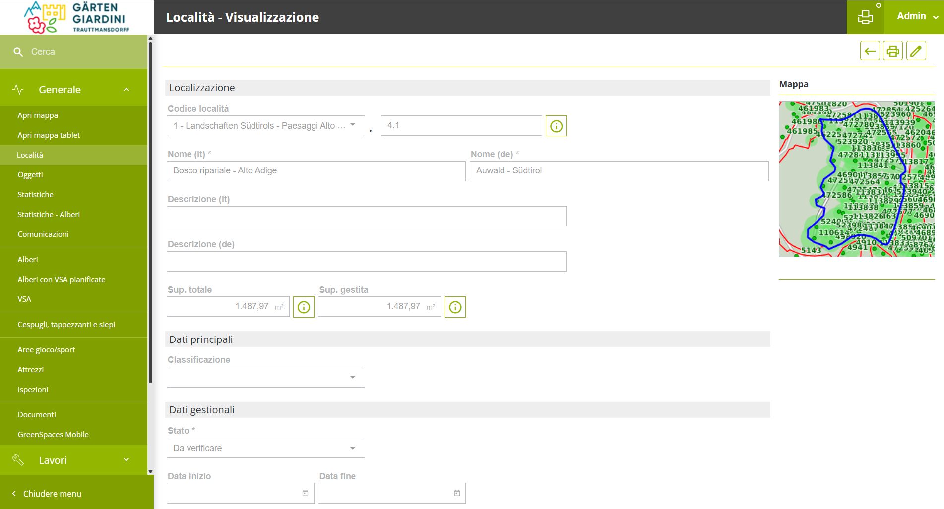
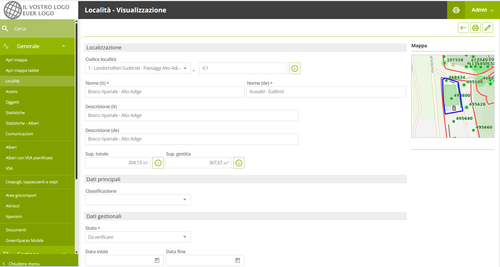
The Web application's interface has been revised to make GreenSpaces easier to use on tablets and smartphones. In particular, the display of the lists has been improved: the upper part of the window, containing the total number of objects in that menu, the action buttons, the filter view, the button cluster that allows you to act on the data at the end of each line, and the lower part of the screen where a popup for the legend has been created. All these changes in the user interface are especially noticeable on small screens.
|
|
Fig 1.1: New and cleaner interface
|
Fig 1.2: Previous interface
|
With this version it is possible to display certain tree attributes as labels on the map. The new map layer "Tree labels" allows the height, trunk diameter and age of the tree to be displayed on the map. The "Common Name" and "Scientific Name", which are now separate, the "Tree Number" and the "Tag Number" have also been added to the same layer group.
|
Fig 2.1: The new “Tree Labels” layer
|
A new “History” tab has been created in the tree form to show changes to certain plant parameters (taxonomy, height, trunk diameter, crown diameter, physiological phase, position). Each time one of these parameters is changed, a row is added to the history table showing the modified value, who edited it and when. In this section the changes made to the tracked parameters in the tree form over time are shown (which GreenSpaces previously tracked but did not display) and, from this update onwards, every single change is displayed in the list, including those relating to the variation in the state of the plant, previously contained in the "Change history" tab. All data can be filtered and exported.
|
Fig 3.1: The new “History” tab in which changes made are listed |
The monitoring printouts provide an overview of the situation concerning sites, trees and jobs. Until now, the printout represented the situation at the time of the request. From now on it will be easier to check what the situation was on a certain date.
From the list of sites it is in fact possible to filter by the new field "Active on date" and the statistics printout will only show those that were present that day.
Alternatively, when printing the tree statistics, the dialogue box now presents the possibility of entering the date to which the statistics should refer (see Fig. 4.1)
While from the planned jobs menu, the statistics printout now takes into account the filter set on the dates (period filter). In addition, the job monitoring printout has now been extended to include not only jobs on trees, but jobs in all categories.
|
Fig 4.1 The new filter in the print dialog box.
|
As part of the Interreg IT-CH VerdeVale project, indices were developed to calculate the environmental value of green areas. These indices are now available to all customers who activate the BENEFITS Module.
In the site form, the new tab "Environmental value" shows the following indices:
-
Average infiltration capacity (calculated from the average infiltration capacity of the different ground covers in the area. A complete census of all elements in an area is required to display this information);
-
Simpson index for tree diversity;
-
Arboreal average size index;
-
Arboreal environmental value.
The calculation of ecosystem services for trees and shrubs has been improved and is now available in some new aggregated lists for easier interpretation.
The environmental benefits of trees and shrubs are calculated daily on the basis of plant parameters and meteorological data, and are visible in the appropriate lists.
New lists have been created to facilitate the interpretation of annual data. For the current year, the annual value shown is the cumulative value up to the day of display and increases daily until the year is completed.
The ecosystem services of the plants of an entire site are summed up on an annual basis and can be viewed in the "Ecosystem Services" tab in the "Site" form.
For the ecosystem services of CO2 storage, CO2 absorption, PM10 removal, and energy saving, an economic value calculation on an annual basis has been added. The unit prices to be applied to each ecosystem service are distinct from year to year, and are configurable by the administrator user. The initial values are entered by R3GIS using official sources (average cost of a tonne of CO2 calculated for each country as calculated by the World Bank, the average price of electricity and the unit social cost of PM10 as reported in the European Ecosense database). If on the 1st of January of the new year no unit price has been entered by the user, the prices of the previous year are automatically copied. If a unit price is changed, the recalculation of the economic value occurs directly when saving the configuration.
With this version we have implemented a new Open Data weather source. Weather data are displayed in the weather dashboard and in the hourly weather data list. In addition, forecasts for the following 72 hours are included and daily statistical values are calculated.
For our customers who have subscribed to a periodic digital tree twin survey with greehill (www.r3gis.com/greehill) for the Smart Tree Inventory, it is now possible to switch from the "Tree" tab in GreenSpaces to the digital tree twin representation on the greehill platform with the simple click of a button.
|
|
Fig 5.1: "Tree" tab with connection button |
Fig 5.2: Recalled greehill digital twin board |
A monitoring issue (MON) can be attached to an object and the resulting job inherits its position. For point objects it is the point coordinates, for areas it is the midpoint of the area and for linear objects it is the midpoint of the line.
This works well for objects in the inventory, such as individual trees.
In the case of issues on objects that are not present in the inventory, the position of the issue was previously lost when the job was created, as it was not linked to any surveyed items.
Thanks to new developments in this release, it is now possible to include the position of the issue with the following two options:
-
If the issue is not linked to any object, its position is automatically used for the resulting job.
-
If the issue is attached to an object, the position of the object is transferred to the job by default, but you can activate an optional flag to still use the position of the issue instead of the position of the object (e.g. when you want to indicate the presence of a hole in a large lawn).
|
Fig 6.1 The check box that allows the geographical position of the reporting instead of using the position of the selected object
|
To solve the difficulty of selecting specific objects for a certain type of job, a new search filter for "Object Number" (pt, Nr.) has been implemented. This filter is available in the object selection phase for a multiple job. In order to be able to use this new field correctly, we recommend that you first fill in/edit the pt/Nr parameter of the objects on which you want to plan the job, e.g. by adding a letter as an indication of maintenance category (e.g. 1A, 2A, 3B, 4B, 5C, etc.) and then filter the objects to be selected for the multiple job by setting the "Nr." field in the filter with the appropriate letter.
|
Fig 7.1 Using the "Nr" filter, it is possible to select specific objects for a certain type of work.
|
If a tag change is detected during a tree assessment, the form that is printed now indicates the change and contains both the old and the new tag number.
|
Fig 8.1 Print with evidence of tag change
|
Risk assessment based on the Areté method was already introduced with the last update to version 5.18 and was activated for some pilot customers. During the deployment, some discrepancies emerged between the Areté protocol (specifically the Excel ARETE_OPEN.xlsx) and the calculation algorithms developed in GreenSpaces. The difference concerned, specifically, the parameters for the classes of moving targets (traffic, pedestrians/cyclists), which have now been corrected and are now calculated dynamically, as it happens in the Areté method. With the latest refinements, it is now possible to activate the risk assessment all installations. However, activation remains on request. If you are interested, please send an email to R3GIS.
The new version of GreenSpaces Mobile makes it easier to view/edit jobs directly from the map: if there is only one job, clicking on the map opens the form directly, while if there are several jobs overlapping geographically, a list opens allowing the user to choose which of the jobs to view.
|
|
Fig 9.1 Jobs on mobile map
|
Fig. 9.1 Job selection list
|
Upon request, it is now possible to integrate your own IAM (Identity and Access Management) based on OpenID Connect (OIDC) standards with GreenSpaces user management. This will make it possible, for example, to log into GreenSpaces with the credentials issued by the portal of your municipality/authority. The integration module is optional and is available at additional cost.
-
Alignment of advanced filters between "Trees" and "Planned Jobs" list;
-
Object selection for multiple jobs by entering geometry;
-
Management of the selection of more than 3,000 objects (1,000 in the previous version) in job planning;
-
Checking the validity of the job type which can be planned for the selected object;
-
Improved job list print header;
-
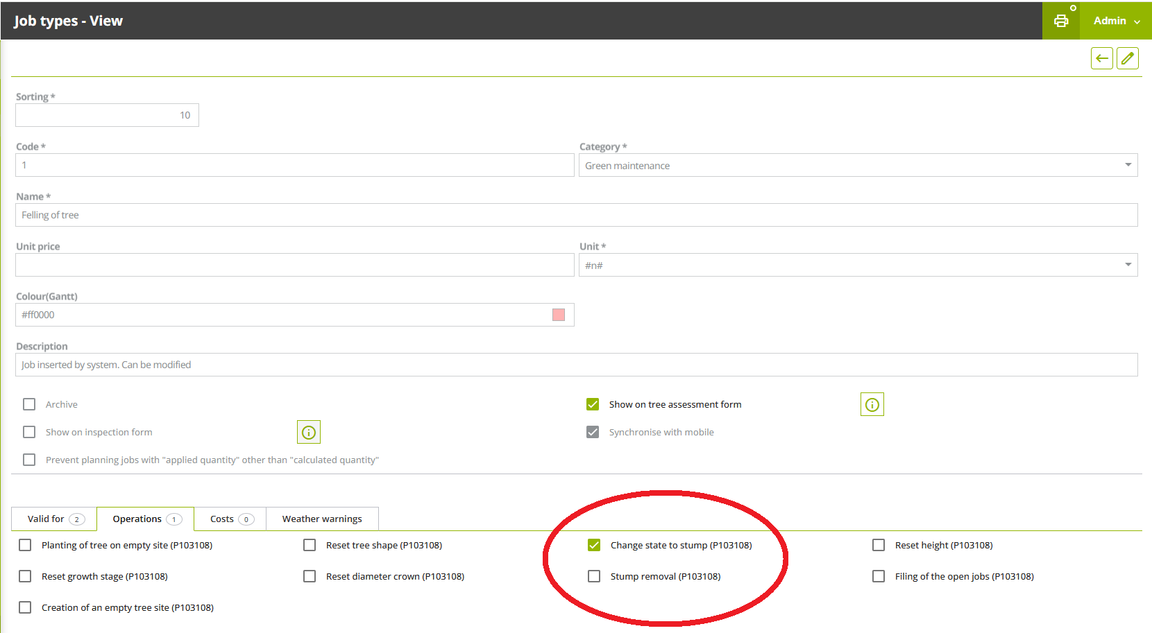
It is no longer possible to schedule tree assessments on stumps and felled trees;
-
Archived equipment is no longer proposed in the list of equipment to be inspected;
-
Mobile app behaviour related to the filters when trying to display more than 500 jobs in the mobile.
Version 5.18
The new version of GreenSpaces introduces the possibility of adding a risk assessment to the tree assessment form.
For this purpose, the menu formerly called “VTA” (with reference to the SIA methodology) was renamed to “Tree assessments”, so that different assessment methodologies can be included.
The new version of GreenSpaces introduces in the tree assessment form the possibility of adding a risk assessment following the Areté methodology.
Risk analysis requires additional information on various parts of the plant in order to assess the probability of failure (PoF) and vulnerability of the site where the plant is located:
-
the initial tree assessment section remains unchanged compared to a traditional visual assessment;
-
the second section allows to asses the risk and probability of failure (PoF) of different parts of the plant, calculating a risk class in real time, based on the values provided by the Arete protocol.
With the release of the previous version (5.17), we introduced some rules for better management of tree assessment forms and to reduce the likelihood of having more than one assessment form “In process” for the same tree at the same time. To sum up:
-
It is no longer possible to create a new tree assessment form on a tree for which there is already a tree assessment form “In process”;
-
It is no longer possible to “Plan an assessment” for a tree for which there is already a tree assessment form “In process”;
-
A rule was introduced that allows validation only in temporal order, i.e. in the same order in which the assessments were conducted.
-
The semantic data of the tree form are not overwritten with the data of the older assessment form to be validated;
-
The jobs proposed by the tree assessment that you are validating will be added to the planning as usual and can be archived manually if they are no longer needed.
The inspection form for play and sports equipment has been revised to bring it into compliance with current regulations. It is now possible to configure different types of inspection, and each type of inspection can have a different list of defects to be inspected.
Furthermore, it is possible to configure a "Controls category" with the flag "Mandatory evaluation". In this case, the simple checkbox (Yes/No) is replaced by three boxes, respectively Yes, No, n/a, which must be filled in (see image). In this way, it is now also possible to explicitly report the absence of a particular defect, while confirming that it has been inspected. The three boxes are also shown in the pdf printout of the inspection.
Within the Interreg VerdeVale project a new statistics extraction tool has been implemented, which allows monitoring the status of some indicators that are strategic for the daily management of urban green. These statistics involve extraction of tables and graphs on certain parameters and are available as 9 additional new types of pdf printouts in the print window of the "Sites" "Trees," and "Planned jobs" menus.
ATTENTION: Statistics prints always extract information on the date the print request is made. For GreenSpaces Enterprise version, statistics prints will only be activated if a filter has first been applied to an individual domain.
-
"Sites" menu: Tables and graphs summarise the characteristics of areas according to their classification.
From this menu, by clicking the print button at the top right , you can now choose the new print type "Site statistics" from the drop-down menu (see images below). Selecting the latter allows you to choose whether to produce a printout for the parameter "Classification", "ISTAT Classification" (for Italian clients only), or both. -
"Trees" menu: Monitoring statistics of surveyed trees provide information on species, height and diameter, tree assessment and growth stage.
From this menu, by clicking the print button in the upper right corner , you can now choose the print type "Tree statistics" from the drop-down menu (see images below). By choosing the latter it will be possible to obtain a printout for one, several or all of the following parameters: "Tree assessment," "Genus," "Height," "Stem diameter," or "Growth stage."
ATTENTION: All tree statistics include in the calculation only trees with status "Living tree" and "Dead tree". For GreenSpaces installations that have the fields "Height" and "Stem diameter" in the tree form configured as classes and not as real numbers, the corresponding and homonymous statistics will be disabled. For trees where the diameter of more than one stem has been registered, the value of the stem diameter for the statistics will be calculated as the overall virtual diameter derived from the overall area of the stem section. -
“Planned jobs" menu: Job status monitoring statistics are available for job categories and activities on trees. From this menu, by clicking on the print button in the top right-hand corner , it is now possible to choose the new print type "Job statistics" from the drop-down menu. By choosing the latter, it will be possible to obtain a printout for the parameter "Jobs by category", "Jobs on trees" or both.
ATTENTION: Job statistics printouts do not include in the calculation jobs in the status 'Archived' or 'Proposed'. For statistics of jobs on trees the software considers only job types valid exclusively and only for the trees (green code P103108).
Until now, it was possible to set the "End date" field in the form of a site or playground even with a future date, immediately archiving the object and creating anomalies in the database. With this update, in order to avoid inconsistencies in the database, this issue has been resolved by preventing (and alerting) the user during compilation (see image below) from setting an "End date" in the future.
The "Homogeneous zone" is an attribute of the "Sites" form, which can be activated at the customer's request, and which identifies the level of management of different areas, such as intensively maintained areas or extensive zones.
The new version of GreenSpaces introduces the map view of homogeneous zones.
The corresponding configuration menu has been enhanced with the possibility of choosing a colour for each zone that will be used for the map display.
The service is available to all customers who have enabled the "Homogeneous zone" field on their installation.
With the new version of GreenSpaces, it is possible to request R3GIS to enable a new information layer on the map to display additional tree checks. The additional tree check can be found and configured by the client in the corresponding menu under "Configuration".
The symbol used is a halo around the tree point; the user is given the option of choosing colours (check yes/no) as well as an alternative symbol; it is also possible to choose which additional checks to enable on the map.
Customised configuration is done by R3GIS staff, after estimating the necessary effort, within the customer's hour package.
Due to a new energy saving management mode by the android operating system, R3GIS had to change the working of the Mobile App. Some customers have reported a crash of GreenSpaces Mobile when taking photos. The new version of GreenSpaces Mobile requires 2 additional permissions when installing or using it for the first time, namely: notification permission and permission to exclude GreenSpaces Mobile from android's battery saving management.
|
|
|
The App now remains active in the background (recognisable by the icon in the top left-hand corner - see the previous image), until it is intentionally closed (double use of the “back” button or closing by swiping from active Apps.
The new Play/Pause function that can be activated within the WORKS Module is intended to record the hours spent by an operator or team (GreenSpaces users) in carrying out a job assigned to them via job planning.
When a user has enabled Play/Pause on GreenSpaces Mobile, a "Tasks" section appears with a ►Start job button. Clicking on the "Play" symbol automatically changes the status of the job from "To do" to "In progress" and the software starts counting the time spent on the started job. Similarly, if a job is changed from “To do” to “In progress” status, the job is started and the time spent on the started job is counted.
ATTENTION: Any interaction with the Play/Pause button is not taken over by the central database until the user performs a synchronisation. If real-time synchronisation is active on the installation, it will instead be possible to view the start of a job from the web platform even without the mobile app having performed a synchronisation. The 'Real-time sync' module can be purchased separately from the WORKS Module.
A job that has been started can be paused and then restarted as many times as necessary: with each pause, the job's time count is interrupted and then restarted when the play symbol is clicked. Even when the task is paused, the status of the job remains classified as "In progress".
Once the job is finished, the user must change the status of the job by selecting "Completed" from the relevant drop-down menu. If the task is still running at the time of the status change, the change to "Completed" automatically stops the task and the work time count is also interrupted.
If a job is scheduled for several users, the following aspects must be considered:
-
The job changes to "In progress" status when at least one user has recorded a "Play" on that job;
-
The counting of the time spent on the execution of the job by each user works exactly as described above (i.e. there will be a time entry for each user based on their Play/Pause);
-
The job can only switch to "Completed" status when all users scheduled on the job have completed it.
|
It is now possible to associate one or more photographs in GreenSpaces Mobile when changing the status of a job and setting it to "In progress". Entering the edit tab of a planned job and setting the status to "In progress" will activate the section for adding photographs to be associated with the new job status; you will be able to capture multiple pictures and select the main one. |
|
During synchronisation these photographs are uploaded to the central database (GreenSpaces Web) and will no longer be visible from the Mobile App. It is however possible to download the main image by using the respective button in the job form. |
In order to make it easier to identify trees or other objects on which to carry out field work, a map has been added to the "Jobs" module in GS Mobile to consult the location of jobs. This functionality is similar to the existing map for trees and tree assessments.
The position is displayed on the map in two ways:
-
Precise for work planned on a single point object;
-
On the centroid of the geometry for work on linear, polygonal, or multiple objects
|
|
|
Version 5.17
Until now, in GreenSpaces, it was possible in the "Companies'' configuration to fill in the "End date" field as simple information, to indicate, for example, the end date of the contract. However, entering the "End date" had no effect on the company-related functionality in GreenSpaces. From this version onwards, the archiving of companies also becomes functional. It is now possible to archive a company that no longer operates on the platform, by following the rules below:
-
It is only possible to archive a company, then fill in the "End date", if the system finds no more active users belonging to it and/or outstanding jobs assigned to it (see image below - archiving rules).
If some users belonging to the company are still active, they must first be deactivated. In addition, all outstanding jobs must be closed, files or assigned to another company. This can be done by filtering the jobs assigned to the company that is being archived from the “Planned jobs” menu, and by changing the status or assigning the job to other companies via the “Multiple edit” tool. Until the conflicts are resolved, it will not be possible to set the “End date” for a company.
-
The "End date" entered, must be prior to or equal to the date on which the archiving is done. It is therefore not possible to enter a future "End date". In addition, the "Companies" configuration menu has been supplemented with new filters that allow you to search for historicised companies ("Show history"). They will appear in the lists with the wording in italics on a grey background. In the "Site" form, only active companies and/or companies with temporary visibility on that site will be visible by default. To also view companies that have worked there in the past, simply activate the search filter "Show history" (see image below).
With this release, print management in GreenSpaces has been updated. It is now possible to create customised prints for each customer. The customised print will appear as an additional choice in the drop-down menu, where all standard prints are located (see photo).
This new development allows R3GIS to configure custom prints in GreenSpaces and to generate new or modify existing prints as requested by the customer. This activity is carried out as part of the hours package. To request an estimate for one or more customised prints, send an email to support@r3gis.com.
In order to improve the management of the VTA forms, some rules were introduced to reduce the probability of having more than one VTA form “In process” for the same tree at the same time. In case an “In process” VTA form is already present in the system:
-
It is no longer possible to create a new VTA form on the tree;
-
It is no longer possible to "Plan VTA" for a tree;
-
There is an additional control for managing multiple VTA forms, which means that they are only validated in temporal order, i.e. in the same order in which they were created.
This resolved the anomaly whereby VTA forms could be validated without taking into account the date of the in-field evaluations, creating inconsistencies in the database.
With this release, the behavior between Web and Mobile has been standardised with regard to the jobs visible in the "VTA" and "Inspection" forms. Only jobs that are valid for green codes subject of the form are visible in the "VTA" forms for trees or "Inspection" forms for equipment.
Concretely, if a job type is to be visible in the "VTA" form so that it can be proposed when filling in the checklist, either from the Web or from the Mobile, this job type must first be matched to the object type "P103108- Tree" and must also be flagged as "Show on VTA form".
Similarly, if a job type is to be visible in the "Inspection" form so that it can be proposed when the inspection is done, this job type must first be combined with the object type "P214250 - Simple playground equipment", "P214251 - Complex playground equipment" and/or "P214288 - Sports equipment" and in addition must be flagged as "Show on inspection form".
This means that maintenance work that does not directly concern the tree equipment, e.g. "Lawn Mowing" or "Pavement Maintenance" in order to become visible in the "VTA" or "Inspection" forms, must first be made "Valid for" green codes for trees and playground equipment, and then they must also be flagged as "Show on VTA form" or "Show on inspection form".
The job created in this way will be associated with the tree or equipment being inspected. If the unit of measurement of the job is other than n, (e.g. sqm or m), the "Calculated quantity" in the proposed job will be 0. Before closing the job, it remains possible to edit the assigned objects and possibly change the "Applied quantity".
When filtering lists, the functionality of advanced filters has been unified throughout the application, and the logical operator between the filter fields is AND: only objects that satisfy all conditions at the same time are therefore selected. For example, if the filters "Status" = "Living tree", "Lodge pole" = "yes" and "Stem diameter from" = "50" are set in the advanced tree filter, the list will contain all trees that have the status "Living tree" AND have a lodge pole AND have a stem diameter greater than 50 cm.
In addition, the search process has been optimised by making the advanced filters faster.
In this version, the option of managing rest days directly in GreenSpaces has been introduced. In a new menu in the "Rest days" configuration, it is possible to configure non-working days of the week, where by default "Sunday" is registered as the day off.
In the existing menu for the management of "Public holidays", it is possible to enter the dates of public holidays, which can also be taken into account when calculating the dates of a job.
In the configuration of the "Priority" of jobs, it is possible to decide whether or not rest days and public holidays are taken into account when calculating the dates set for a job. By default, calendar days are counted when calculating the "Start date" and "End date" of the job. With the new functionality it is possible to change this behaviour so that only working days, excluding rest days and holidays, are counted between the "Start date" and "End date" of the job.
For example, for a job with an execution period of 30 days, in the default mode 30 calendar days are counted between "Start date" and "End date", whereas with the "Working days only" mode, 35 calendar days elapse between "Start date" and "End date" of the job (equal to 30 working days + 5 Sundays).
For some customers, the GreenSpaces platform contains a standardised list of taxonomies. This list consists only of verified and existing scientific names and is used for the calculation of ecosystem services in the BENEFITS Module and for the calculation of water requirements in the WATER Module. Until now, the modification of these taxonomies was completely inhibited.
From this version of GreenSpaces onwards, it is possible to configure certain parameters for standard taxonomies. For each taxonomy, it is now possible to set:
-
The association with different green codes, indicating that it is valid for tree, shrub, hedge, shrub area or other green code representing "Vegetation" (see image below, "Valid for" field);
-
The "Common name", as this may vary in different cities, regions or countries;
-
The relevant "Description".
The scientific names remain unmodifiable; should you notice any inconsistencies, please report them to support@r3gis.com. The possibility of adding new botanical species also remains unchanged.
A search bar has been implemented to facilitate access to the application's functions. The bar, located to the left, above the main menus, allows the entire menu to be searched by typing even just part of the searched item. This makes it quicker to find items, especially in the longer sections of the menu, e.g. "Configurations".
When conducting the census or editing a tree record in the field with the Mobile App, after saving it, it will immediately be possible to identify the new or modified tree in the map, which will be graphically highlighted in orange until the following synchronisation (see image below).
Click on the "?" symbol to display the "Legend" illustrating the new graphical highlighting.
In the new version of GreenSpaces Mobile, when inserting a new object (tree, equipment, issue...), a search by site code or name can be applied when selecting the "Site". This change makes inserting a new object much quicker than in previous versions where it was necessary to scroll through the list of all available sites.
All sites are now sorted in the alphabetical order of "Site code" as the main modality. This is the default option.
From the "Settings" menu of the GreenSpaces Mobile App it is now possible to configure the order in which the sites are displayed: in the "Site search" section it is possible to choose whether the first sites in the list are displayed by proximity or by usage.
-
Order by use: if some objects have already been entered by GS Mobile in the last session, the last 5 sites used are shown at the top of the list, followed by the other sites in alphabetical order;
-
Orer by proximity: if the current location of the device is detected for the insertion of the new object, the site is automatically assigned according to the detected location. It is however possible to change the site manually via the list. The 10 nearest sites are placed at the top of the list in order of distance from the current position. For these 10 sites, the distance of the current position from the nearest vertex of the polygon, which defines the boundary of the site, is indicated. The other sites follow in alphabetical order.
Many synchronisation problems between App and Web application are due to an unstable connection. With this update, in the event of an interrupted synchronisation, the data entered on the App is locked so that it cannot be modified further. In fact, in cases where a GreenSpaces Mobile synchronisation is not completed correctly due to a disconnection of the device, some data may nevertheless have already been transmitted to the central database. If the user had the opportunity to change this data again, a conflict could arise at the next synchronisation.
To avoid conflicts and inconsistencies at the next synchronisation, items already synchronised now become non-editable.
In this situation, the user is informed when restarting the app and when attempting to modify an already synchronised object, requesting a new synchronisation.
With the 5.14 release, the mandatory detection of the tree position in the field was introduced when editing the form in GS Mobile. To make the user experience more flexible, we have made this parameter configurable on demand for the whole installation. The detection of the tree's position when conducting the census will be mandatory by default, but customers who wish to change the behaviour of the Mobile App can request the removal of the mandatory requirement by writing to support@r3gis.com.
-
An indication of the reference system set in the EPSG encoding was added to the map window;
-
The status of each job has been added to the “Tree” form printout;
-
MON Issues created by a user of a company are no longer assigned to his company. They become visible to everyone and can be assigned to a company during validation;
-
In the company form, only active users are displayed by default. By means of a filter it is also possible to display users who are no longer active;
-
The form of a “Job” originating from a VTA, now contains a link to the same “VTA form”, making navigation easier;
-
Printouts older than 30 days are automatically deleted from the application;
-
In the "Jobs" module on GreenSpaces Mobile, the option of filtering by "Job number" has been added.
Version 5.16
This function is available on the GreenSpaces Mobile app in the sections Trees, VTA, Equipment, Inspections and Jobs for each new form that is created or an existing one that is edited. Until now it was possible to insert only one new picture at a time. With this new development it is possible to take multiple pictures for the same object. By pressing the button “Add picture” it is possible to take a picture using the mobile device's camera. Upon confirmation, the picture will become visible in the “Photo” section, while the button “Add picture” will remain active, thus offering the possibility of taking new images. During the next synchronisation, all pictures taken will be uploaded to the server and can then be displayed on GreenSpaces Web in the “Images” tab of the corresponding object form. The first taken picture becomes the main image and will be displayed on the object form. It is possible to choose a different main picture, either while capturing on the Mobile app or at a later stage from the Web app. If there are several images, the main picture is marked with a green symbol. This update does not currently affect the “Issues” section.
In the menu “Trees with planned VTA” using the button
it is now possible to export an adequately filtered list of trees in Excel format. This allows easier data management outside GreenSpaces.
It is now possible to import P1 shapefiles (plants) into GreenSpaces even without having filled in the field “PT” (tree number). If on the installation on which you are trying to import the shapefile, the field "Tree Nr." is mandatory and the shapefile does not contain this information, the imported plants are marked as “being processed” so that the tree number can be assigned later.
A new field “Crown Ø” has been added to the forms of “Shrub” (P103109) and “Shrub in a vase/planter” (P103259), that can be found in the "Shrubs, shrub areas and hedges" menu. This will make it possible in the future to calculate the environmental benefits not only of trees, but also of individual shrubs and potted shrubs.
Version 5.15
When a new GreenSpaces version is released, each user is informed about the update via the pop-up window “GreenSpaces update”, that opens at the first login. From this window the user can open a web page in their preferred language, to discover all the details of the software changes. The pop-up window will be accessible from the “About" menu at the following logins.
It is now possible to perform actions and modifications on several jobs simultaneously through the “Multiple edit” button in the “Planned jobs” menu . This feature, which has been requested by many customers, is similar to the multiple edit already present in the tree menu: apply filters to select the jobs to act on, then activate the “Multiple edit” button.
The following three actions can be now performed:
- Edit company/team: massively edit the company to which the jobs are assigned (if the advanced works module "Works" is active, the team can also be edited).
Procedure:- from the "Planned jobs" menu, run the filter required to identify the jobs for which the company is to be assigned/modified
- click on the new "Multiple edit" button on the top right, which will open the list of previously filtered jobs
- select all or part of the filtered objects
- confirm the selection with the button
- select the "Modify job data" action - see image below
- compile field "Company" ("Team" only with "Works" module active)
- save changes by pressing the “Save” button
Upon confirmation of the operation, the system will display a report message confirming that the modification has been made. - Modify job status: change the status of the job to "Completed", "Replanned" and “Filed”. For each of these actions you will be prompted to compile the corresponding mandatory fields.
Procedure:- from the "Planned jobs" menu, run the filter required to identify the jobs for which the status is to be modified
- click on the new "Multiple edit" button on the top right, which will open the list of previously filtered jobs
- select all or a part of the filtered objects
- confirm the selection with the button
- select the "Modify job status" action - see image below
- select the new status from the drop-down menu (choose between "Completed", "Replanned" and “Filed”) and compile the required fields
- save the modification by pressing the “Save” button
Upon confirmation of the operation, the system will display a report message confirming that the modification has been made. - Delete jobs: in this case the selected jobs will be completely deleted from the system. For this to be possible, there can be no pictures and documents attached to the job. Similarly, jobs selected for deletion must not be part of or originate from a specific Workflow (VTA, ISP, MON, NCx)
Procedure:- from the "Planned jobs" menu, run the filter required to identify the jobs which should be deleted
- click on the new "Multiple edit" button on the top right, which will open the list of previously filtered jobs
- select all or a part of the filtered objects
- confirm the selection with the button
- select the "Delete job" action and flag the option "Delete all selected jobs. The action is irreversible" if you want to finalise the operation. - see image below
- save the modification by pressing the “Save” button
A summary is given at the end of the operation. If the action cannot be completed on all jobs, a filter can be set to display the jobs to which the action has not been applied, so that any conflicts can be resolved immediately.
Attention: all actions described above are irreversible! A maximum of 100 jobs can be edited at a time. This functionality is only available to users belonging to the ADMIN and OPERATOR_PLUS groups. Multiple job completion is therefore no longer available for OPERATOR/OPERATOR_TREE and OPERATOR_PLAY users.
A new job status "In progress" has been introduced in the "Planned jobs" menu to allow companies to indicate the start of activities for a job that may take several days to complete. This new status is visible both in the legend, highlighted with a new colour (pale blue), and searchable in the filters - see image below.
After synchronisation, the job that has been put "In progress" by the operator in the field will be highlighted in pale blue on the Web interface of GreenSpaces. A job with this status can not be deleted, replanned or filed. The information on the status change is tracked and will always be available directly in the job form, in the tab "Change history" - see image below.
While compiling or editing a “VTA” form or an “Inspection” form, the inspector can see the currently planned jobs, as well as propose new ones. If a job is planned on one tree or one equipment item only and if it is assigned to the inspector's company, it can be set to “Completed” directly from within the VTA/Inspection form. Using the new button the inspector can now view the jobs that have been completed in the past on the specific tree/equipment item with their completion date.
This function allows the inspector to have a complete overview of all past and future activities related to the target of their inspection.
The new search function described below stems from the need to facilitate the planning and scheduling of tree assessments. This allows municipalities, for example, to delegate the VTA planning to external companies. Please note that "Plan VTA" is a necessary procedure in order to conduct VTAs in the field using the GreenSpaces Mobile app, but frequently a municipal technician is not aware of how the individual tree assessments will be distributed within the company's team of arborists.
In GreenSpaces, a "Monitoring VTA" job is automatically planned for each tree when a VTA form is validated. The municipality proceeds to assign these "Planned jobs" to external contractors. This process has been made easy through the "Multiple edit" function on jobs described above.
In the advanced filter of the "Trees" in the section "Jobs" the field "Company" has been rendered searchable. This allows the contractor to filter out trees without a planned VTA that are the subject of a "Monitoring VTA" job with the status "Planned" or "Replanned" and assigned to their own Company. It is possible to apply additional filters such as the planning dates for the "Monitoring VTA" job or to select an area on the map.
The contractor can then plan VTAs and assign them to their employees independently. The operator in charge of "VTA planning" can only assign VTAs to users belonging to their own Company.
If there is no "Monitoring VTA" job planned yet, the municipality can apply the same methodology by first creating a new job manually for the trees which should be monitored and assigning it to the contractor. Be sure to unflag the checkbox "Group jobs by site" in order to create a monitoring job for each individual tree. In this way, the status of the job can then be changed to "Completed" directly in the field by the VTA specialist whilst compiling the VTA form.
Jobs proposed in a VTA/ISP form by a user who is part of a certain Company are no longer assigned to the said Company by default, but remain unassigned ("Company" field remains empty). At a later stage, the jobs can be assigned to a specific company in batch through the newly introduced function "Multiple edit" for jobs.
Following several requests from our users, graphic representation of trees on the map has been updated. The dead tree symbol has been changed from a "green cross" to a "green X". Icons have also been aligned between the Web interface and the Mobile app. Below is the new tree status legend.
The style of "In progress" trees has been changed to make them more visible in the "Trees" menu list. With the new release these entries are highlighted in yellow as per the new legend - see image below.
The following new search fields have been added to the advanced filter in the "Trees" menu.
In the "VTA" section:
- With instrumental analyses (yes/no)
- Type instrumental analysis (the tool used)
- Date VTA from
- Date VTA to
In the “Jobs” section:
- Company
- Job number (#)
In the tree list is it possible now to see the trunk circumference instead of the diameter. The option to see both fields is available. The trunk diameter remains the default displayed field. To implement this change, a specific request must be made to R3GIS.
In addition, the trunk circumference value is now displayed as a whole number.
The "Inspections" tab has become more flexible. Defects can be grouped into configurable categories. The default categories are "Equipment" and "Surfacing". Types of inspections in which each defect is to be verified (monthly, quarterly, annual, etc.) can be indicated. After selecting the type of inspection in the form, the list of defects to be evaluated will be proposed accordingly. This function applies to both the GS Web and GS Mobile.
The compulsory evaluation of defects, as required by the UNI EN 1176-1 bis 7 standard, is currently in beta-testing and will be released in a future update. For each category of defects ("Equipment" and "Surfacing") it is possible to indicate whether it is compulsory to evaluate the defects choosing whether they are "present", "absent" or "not applicable". Only after entering a value for each defect, the form can be saved. The possibility of proposing a job when a defect is present remains unchanged.
In order to increase the GreenSpaces Mobile app usability, some elements of the app's graphics have been improved, including: font, size, colours used, text alignment (see "VTA" and "Inspections" forms).
The list of jobs exported in Excel format from the "Planned jobs" menu now contains not only information on individual trees, but also on individual equipment items. Now for each individual job on equipment, information on its number and type (swing, slide...) is also exported.
The advanced job filters have also been improved with the addition of sections for "Equipment" and "Inspections".
Photos taken through GS Mobile are now resized to 1920x1080 px, to avoid saving photos that are too large in the database. Additionally, it is now possible to resize photos uploaded through GS Web. To implement this function, a specific request must be made to R3GIS.
As a part of the WORKS module we have introduced the possibility of Team-management within Companies. Teams can be configured in the menu "Teams" or in the tab "Teams" within a Company form, both are in the “Configuration” section. Each Team must belong to a Company. For each Team it is possible to select the members from the list of users already belonging to the Company and, if necessary, to select the person in charge.
Thanks to this new function, each job can be assigned not only to the company but also to the individual team - see image below.
Teams are taken into account in all other functionalities of the WORKS module.
Calendar
The planned jobs can be scheduled for a specific day and time and assigned to a specific user. This schedule is represented in a convenient weekly calendar. Using the new concept of teams it is possible to schedule a job for individual users or for an entire team, that is composed of a predefined set of users with a predefined team leader, facilitating the planning of field activities. In case the team has a different composition for a particular job or due to the temporary absence of a user, the group of users to which the job is assigned can be changed during the scheduling phase: the user scheduling the job can deselect co-workers, select additional co-workers, or change the team leader.
Cost management
The cost monitoring functionality allows you to record all the resources actually used to complete a job. At the completion of the job, it is possible to register the hours, the equipment and tools used, and the materials consumed for the given activity. In installations where the allocation of each resource to a specific user is active, the team leader can register the resources associated with the individual members of his team.
The resources registered in this way are converted into costs and assigned to the cost centre of the site where the job was performed. In this way it is possible to calculate the company's costs incurred in completion of a job and, if necessary, compare them with the amounts invoiced to the customer.
- PDFs generated through the print function are automatically deleted after 30 days from the date of their creation
- The "Passages" module has been moved from the "Nonconformities" section to the "Jobs" section
- New visualisation of historical job types in the “Planned jobs” list using this icon
- From the GreenSpaces map, it is possible to open the Google Street View in a separate window. With the new update of the map, the line drawn from the initial point and the direction of the view is now also visible
- In each list in GreenSpaces, the total number of filtered objects is displayed in the title bar on the top left side
- In the "Company" form in the "Configuration” section it is now possible to view and edit users assigned to that company. For installations with the optional WORKS module you can manage the company teams in a separate tab as well
- For users of the WORKS module, real-time monitoring of the completion of field work has been improved
- As an improvement of the WORKS module, in GS Mobile a user sees the planned jobs where they are “In charge” indicated with the specific new symbol
Several bugs reported in recent months have been resolved, including:
- Issue fixed with association of NFC tags to equipment in GreenSpaces Mobile app
- Resolved the issue of job type visibility for historical job types in GS Mobile
- Permissions fixed for the standard OPERATOR_PLAY user group so that it no longer can see the “Trees” module in GS Mobile
- The length of the “Notes” field in exported shapefiles has been extended to 254 characters. Notes up to this length can also be imported via shapefile (the 254 character limit is imposed by the Shapefile format)
- Fixed the problem of overwriting the "Created” (date) and "Created by" with the shapefile import
- Fixed bugs of simple and advanced filters
- For customers with the modules BENEFITS (calculation of tree ecosystem services) and WATER (calculation of tree irrigation requirements), the tabs displaying ecosystem services and water requirements, have become visible again in the tree form
- The issues with filters applied to export data has been corrected (modules BENEFITS and WATER)